

 Odisha has become the first state in the country to implement Climate Change Action Plan by launching real-time flood forecasting model.
Perennially troubled by flood and extreme weather conditions, Odisha government unveiled this unique real-time flood forecasting model for river Mahanadi which will provide advance warnings up to 72 hours.
The soil and water assessment tool (SWAT)-based hydrological model will use rainfall data provided by India Meteorological Department (IMD) for predicting flood in the catchment areas of the river, which causes widespread damage on its path during monsoon.
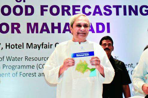
Chief Minister Naveen Patnaik formally unveiled the forecasting model, designed by Water Resources Department with technical assistance from Climate Change Innovation Programme(CCIP).
The model will provide forecasts for three locations – Hirakud, Kahirmal and Munduli. It uses a simulation of flow based on rainfall predictions over Mahanadi river basin.
The forecasting aims at accuracy because of incorporation of a digital elevation model which uses 30 metre elevation data. For real-time flood prediction, the entire river basin has been made part of the model, including the upstream catchments in Chhattisgarh to maintain the hydrological continuity.
“The model will increase warning and reaction time by 36 hours to 72 hours and help better management and planning. The flood forecasting will be greatly dependent on IMD which will provide processed rainfall data to the Department for real-time prediction. Apart from merged data collected from satellite and rain gauge stations for the last 24 hours, information on current situation and forecast of rainfall using both global and regional forecasting models will be provided”, said Pradeep Jena, Principal Secretary, Water Resources Department of Government of Odisha.
“Processed and gridded rainfall data from regional models of IMD will be used by the Department for flood forecasting. Such data is generated twice a day and will greatly help the prediction system,” Jena added.
The existing flood forecasting system is over-dependent on past rainfall inputs which were sourced from rain gauges and radars. Besides, it also does not take into account dynamic soil moisture conditions and upstream interventions such as dams and reservoirs and the water release details.
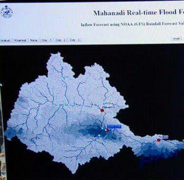 Mahanadi, which flows through Chhattisgarh and Odisha, drains over a whopping 1.41 lakh sq km.
How it works:
● It uses a simulation of flow, based on rainfall predictions over Mahanadi river basin
● Forecasting aims at accuracy because of incorporation of a digital elevation model which uses 30 metre elevation data
● For prediction purpose, entire river basin has been made part of the model
● Upstream catchments in Chhattisgarh included to maintain the hydrological continuity
● Model will increase warning and reaction time by 36 hours to 72 hours and help better management and planning


